Mapping Our Paths: The Fascinating Reasons Behind Our Road Networks
Have you ever unfolded a map or navigated using GPS and found yourself questioning the logic behind the winding roads and seemingly circuitous highway routes? At first glance, it might appear that a straighter, more direct path between two points would have been more efficient. However, the layout of our roads and interstate systems is far from arbitrary. It’s a complex tapestry woven from geographical constraints, historical precedents, governmental boundaries, and decades of planning and development. Understanding the multitude of factors that have influenced their construction reveals a fascinating story of adaptation and ingenuity.
The Lay of the Land: Geography’s Guiding Hand
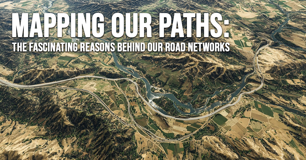
Perhaps the most significant determinants of our road networks are the inherent characteristics of the land itself. Topography and geology have played, and continue to play, a crucial role in dictating where roads can be built. Early trails and subsequent roads often naturally followed the path of least resistance, frequently paralleling rivers where the terrain was relatively level and stable. Conversely, formidable natural obstacles such as steep mountain ranges, impassable rock formations, and expansive bodies of water have forced roads to curve, detour, or simply avoid them altogether. Every bend, every change in direction you encounter on a road is often a direct result of navigating some inherent geographical challenge.
The Influence of Borders: Lines on the Map
Governmental borders and boundaries, while perhaps not the primary drivers, have also subtly shaped our road systems. Historically, road maintenance and development have often been organized and funded based on jurisdictional lines. While not a major factor in the initial placement of routes, the presence of city, county, state, and even national borders has influenced how and where roads are maintained, upgraded, and sometimes even laid out, particularly at the intersections of these jurisdictions.
Echoes of the Past: Established Routes and Trails
It’s easy to forget that many of our modern roads and highways have deep roots in the historical movements of people and goods across the land. The trails forged by westward-bound settlers and the routes used for cattle drives in the early days of our nation often became the foundations for subsequent roads. Remarkably, if you examine historical maps, you’ll frequently find that modern freeways and major thoroughfares closely mimic these old, horse-drawn trails, a testament to the efficiency of these early paths in traversing the landscape.
The Iron Horse’s Legacy: The Railroad Influence
Before the widespread adoption of the automobile, railroads were the dominant mode of long-distance transportation. The railway companies invested significant resources in determining the most efficient and commercially viable ways to connect different locations. Their decisions on track placement were based not only on geographical considerations and existing established routes but also on the desire to connect key population centers and economic hubs along their lines. As automobile travel grew, many early roads were often built parallel to or in the vicinity of existing railway lines, leveraging the established corridors of transportation.
Connecting the Nation: The Interstate Era
The most recent and arguably most significant influence on our vehicular transportation network is the Interstate Highway System. This ambitious national project, spanning decades of planning and construction, has created an incredibly efficient web connecting the entirety of the United States. Interestingly, a comparison of pre-interstate highway maps with the modern Interstate system reveals that the new network often followed and upgraded some of our most heavily traveled and well-established existing routes, streamlining travel and commerce on a national scale.
While navigating our road systems might sometimes feel frustratingly indirect, a closer look reveals a remarkable level of efficiency born from generations of trial and error, adaptation to the landscape, and strategic planning. Our roads are not simply lines on a map; they are a testament to our history and our ongoing efforts to connect and traverse this vast country.
Just as our highway system strives for efficiency, finding the right car insurance shouldn’t be a convoluted journey. Contact one of our independent insurance agents today. They can efficiently navigate the complex world of insurance, shopping from our network of reputable companies to find you the best coverage at a price that fits your budget. Connect with us to get started on a more efficient path to quality car insurance.


